Using Foursquare data to reveal spatial and temporal patterns in London
Abstract
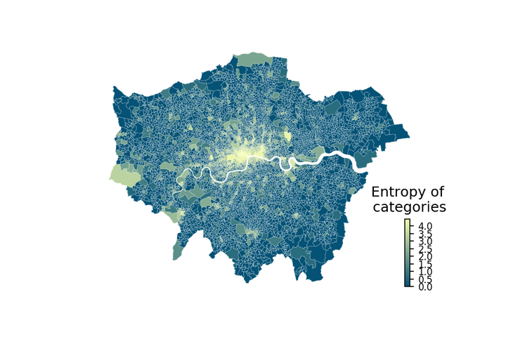
Understanding the functional structure of contemporary cities can find many applications ranging from urban planning to local governance regarding inequality issues. This exploration is often constrained by the availability of large-scale data at fine spatio-temporal resolution. Longitudinal data, such as the Foursquare data, allow researchers to explore different aspects of the functional structure of cities, such as the role of places and the human mobility that occurs between them. However, never mind their size, this type of data is often incomplete, capturing only parts of the functional city due to the biases in the data collection that might represent a part of the population only. In this paper we explore how Foursquare data can help unveil aspects of the functional structure of London. We explore the spatial pattern of venue locations and visit patterns captured in the Foursquare data. We also touch upon the temporal patterns of these data, as well as the interactions between categories of places (as derived by the semantic information that comes with the venues). Our findings reveal some of the characteristics and limitations of the Foursquare data with regard to investigating the functional structure of London and other cities..